I don’t have a great memory as a general rule. I can be rather unobservant, particularly with landmarks and directions, so when things started looking unfamiliar, I didn’t think much of it. I started following the blue trail markers in the middle of my hike a while back, and I can’t tell you exactly why, but it seemed right. It wasn’t until I stumbled into a clearing next to a big wooden sign that said “North Country Trail” that I knew I had taken the path less traveled—and it made all the difference. 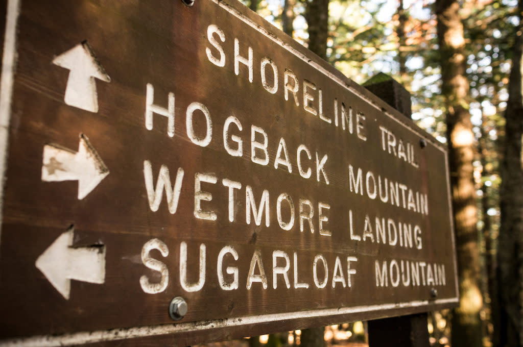 About a month before this face-palm moment, a new friend asked me to go on a hike and asked only whether I was in the mood for a short hike or a long one. I chose long, so we went to Hogback Mountain. I hadn’t yet heard of it and had no idea what to expect, but I can say that high-waisted, mom-jean shorts, sans stretch on a hot day were a terrible idea. (Once we got to the top of the mountain and took a load off, I left a wet spot on the rock we were sitting on and vowed to start doing more cardio.) But the view at the top of Hogback was absolutely breathtaking. It actually took my eyes a second to adjust because of the expansive view my mind was attempting to take in all at once. I can’t wait to go back once the leaves start changing.
 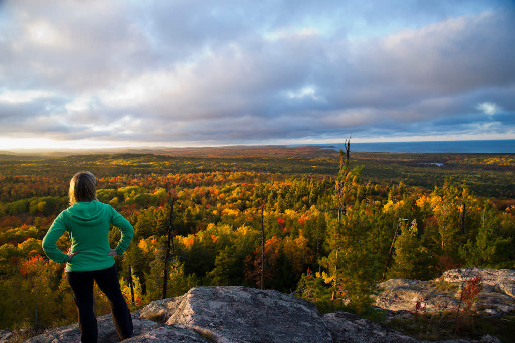 With my friend, though, I was led up the mountain, and I’m going to tell you, with some shame, that I had no idea we were following markers the whole time. I thought he just knew the way because he’s from the area. I went back to the Lily Pond & Hogback trailhead a few weeks later to do the hike again by myself, figuring I would follow the well-worn path up the mountain, and discovered there were colored markers all along the trail. I know this probably seems like a no-brainer to many of you, but I grew up on military bases and my family is very indoorsy. Hiking is brand new to me. When I discovered trails have markers to follow, it made me feel better knowing that the local friend who had led me up the mountain weeks earlier, likely didn’t have the trail memorized himself. Because he used the help of others who had gone before him, in the form of a beaten path or a white marker nailed to the trunk of an aspen, I began a hike of my own. I planned for about two hours roundtrip as it had before. And if I hadn’t started following a different color trail marker halfway through my hike it probably would have. Whoops. I hadn’t seen a single other person during the two hours I’d been criss-crossing trails. I considered calling for help, but who would I call? And even if I did have someone to call, how was going to describe to them where exactly I was? This was all completely irrelevant because I didn’t have any cell service anyway.
  I took a deep breath and a drink of water and decided to start back the way I came. Logically (I swear I am capable of logic.), I knew that as long as I followed the markers, be they the ones I set out intending to follow or not, I would eventually arrive somewhere, so I resolved to retrace my steps as best I could. It’s a good thing most trails only go two ways, so stopping at splits and double checking every time is the easiest way to get back to where you came from. It took a good hour or so to find my way back to where the blue and white markers intersected and another hour from there to get back to the trailhead, but I did my best to keep calm and enjoy the spectacular beauty of the hike, of which there was plenty. I collected leaves and flowers I didn’t recognize so I could identify them later; I stumbled on plaques that detailed some of the area’s history; and I may not have made it back to that spectacular Hogback view, but there were a number of vantage points along my lost trail that stopped me dead in my tracks and took my breath away. Getting lost isn’t the best. Here’s some tips for hiking around Marquette: Research the trails before you go: If you can’t print maps/ screen grab them at your phone, and be sure to zoom in on intersections. Here are some basic safety resources: Think your lost? Follow these tips, not your heart. Safety’s first, plan ahead. Know the terrain, study the trails. Don’t forget to double-check this checklist. Are you ready to take on Hogback? Find out here. Words By Brenna Womer
Author